Nov 29 2011
Maps and Cars
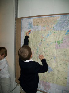
One of our new materials in class is cars. We have a tub with various sizes and types of cars that the kids love making ramps for and building streets for. Today, I noticed several friends running their cars over maps we have set up in the classroom. Aidan was tracing a thick red line on our Indianapolis map on our wall. “Its driving!” Aidan and I talked about how the thick red line made a box around Indianapolis. I explained that its a very busy highway- the 465 Interstate! Michael came over and began tracing his car along 465 as well. I am really excited to see where this global, map, geography investigation takes our class.
No responses yet
Leave a Reply
You must be logged in to post a comment.

